Subject: Idaho
Period: 1865 (dated)
Publication:
Color: Black & White
Size:
17 x 15 inches
43.2 x 38.1 cm
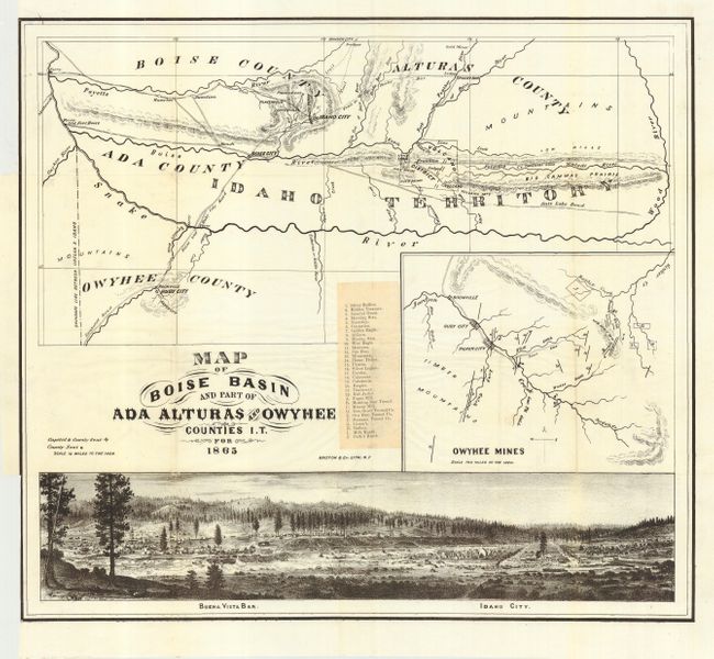
A great map of the Gold Regions of Idaho with a large birds-eye panorama at bottom of Idaho City, the largest city in the Northwest at the time, and the adjacent settlement of Buena Vista Bar. In 1862 George Grimes and a party of prospectors establish the Boise Basin mines, leading to the creation of Idaho City. The main map shows the region of southwest Idaho including a portion of eastern Oregon. It extends to include Ruby City and Silver City in the southwest, the ferry on the Payette River at the Oregon/Idaho border, and east to include Idaho City, Rocky Bar, and beyond to show the Salt Lake Road. The map locates and names the Boise and Ruby City Road, the Humboldt Road, the Emigrant Road, numerous trails, Gold Mines, ranches, rivers and general topography. A large inset map details the Owyhee Mines at a scale of two miles per inch. Pasted on the map is a list of 32 mines and ranches in the Owyhee inset, keyed to the map. The panorama is a finely rendered lithograph that details the town's buildings, streets and topography. No record of the map or its source is identified. It may have been included in the elusive "Emigrant's Guide" authored by Charles Burlingame Waite and published in Chicago, but no copies of the guide have been located. Harold Berliner, printer, reproduced the map in color in a limited issue in 1876 from a copy in the Library of Congress, but the LOC currently shows only the Berliner reproduction. An early and important work on the Idaho Gold Rush. Map is encapsulated in archival Mylar.
References:
Condition: A
Clean and bright example with full margins on thin banknote style paper. Folding, as issued, with binding trim at left just to neatline. A couple of tiny holes at fold intersections, visible when held to light, still very good.


