Catalog Archive
Auction 111, Lot 207

"Seno Mejicano. Carta de la Costa Occidental de la Florida", Spanish Admiralty
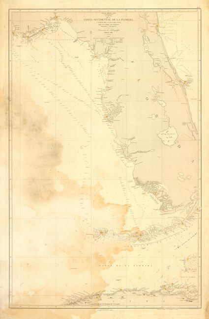
Subject: Florida

Period: 1862 (dated)

Publication:

Color: Hand Color

Size:
24.2 x 38 inches
61.5 x 96.5 cm
Download High Resolution Image
(or just click on image to launch the Zoom viewer)

Large-scale sea chart covering the coastal area of Florida and northern Cuba in great detail. Includes soundings, hazards, shoals, rocks, lighthouses, etc. Some detail in the interior including all forts. Strangely, the map cuts off the northeastern coastal area between Miami and Hutchinson Island. Map by M. Rodriquez with the embossed stamp Direccion de Hidrografia - Madrid. A scarce issue that will benefit from professional cleaning.

References:

Condition: C

Extensive staining in the gulf, not affecting map, three marginal tears just to neatline, else very good.

Estimate: $600 - $800

Sold for: $450

Closed on 6/8/2005

Archived