Subject: California
Period: 1915 (dated)
Publication:
Color: Black & White
Size:
19 x 26.3 inches
48.3 x 66.8 cm
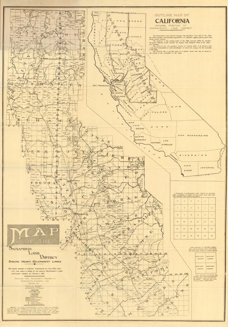
This interesting land promotion map "contains complete, authentic and reliable information on where the Government Land is located ... shows all railroads, principal rivers, counties, railroad stations, post office" and more. Large inset map of California showing that the Sacramento Land District encompasses most of Northern California. Folds into printed wrappers with title: The Homeseeker's Guide to Government Lands, containing 16 pp. of text explaining the map and how to use it. "This map is the result of many years' research and study by John F. Armstrong, for 12 years Register of the Land Office at Sacramento, and Chas. L. Gilmore, an experienced Engineering Draftsman." A scarce issue that is in like-new condition.
References:
Condition: A+


