Subject: Arizona & New Mexico
Period: 1849 (dated)
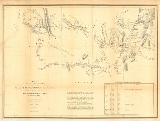
Publication: Navajo Journal, 31st Congress, 1st Session, Senate Exec. Doc. No.64
Color: Black & White
Size:
27.8 x 20.2 inches
70.6 x 51.3 cm
This map is the product of a punitive expedition against marauding Navajo Indians. The expedition traveled from Santa Fe to Jemez Pueblo, then on the Navaho trail to Chaco Canyon, and via Washington Pass to Canyon de Chelly. They engaged the Navajo in their strongholds at Chaco Canyon and Canyon de Chelly where the tribe was soundly defeated. The soldiers then explored the area and were the first white men to discover and describe the prehistoric pueblos in the region. The return route traveled south of the Zuni Pueblos and east past Inscription Rock and Laguna Pueblo to the Rio Grande. A very early description of Canyon de Chelly. A seldom seen map that Wheat calls "an arresting production, bringing out many new details of the region." Wheat used the map as the frontispiece to Volume III.
References: Wheat (TMW) 641.
Condition: B
Issued folding, now backed with archival tissue. A 3" tear into blank area of map at binding trim and a small puncture hole, both well closed on verso.