Subject: United States - Northwestern
Period: 1904 (dated)
Publication:
Color: Printed Color
Size:
21.8 x 23.8 inches
55.4 x 60.5 cm
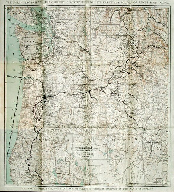
A handsome promotional that includes the railroad routes and all station locations. Map covers all of Washington and Oregon and extends to show western Montana and Idaho to include Boise, Mountain Home, Idaho City, Fisher River, etc. Locates mines, roads, Indian Reservations, and much more. Above the map: "The Northwest Presents the Greatest Opportunities for Settlers of any Portion of "Uncle Sam's" Domain." Below the map: "For Grains, Grasses, Fruit, Live Stock and Minerals the Territory Embraced by this Map is Unequalled." Map is dated 1895 and folds into 88pp pamphlet titled: Oregon, Washington, Idaho and their Resources, dated 1904. A fine promotional piece.
References:
Condition: A+
Map is very fine with no flaws at all. Covers with a little toning or surface soiling, contents fine. Cover with small amount of paper pull-away at staples.