Subject: United States - Northwestern
Period:
Publication:
Color: Hand Color
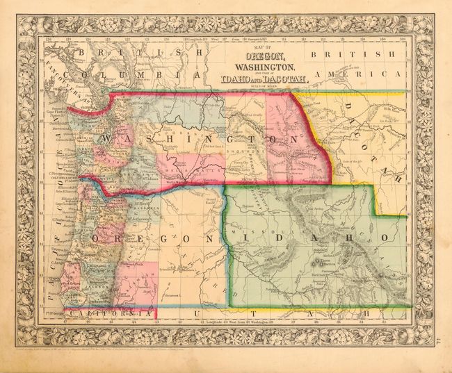
A very nice collection of maps that show the rapid growth and development of the region over a quarter of a century period. 1) Map of Oregon, Washington, and Part of Idaho and Dacotah, S.A. Mitchell, 1860 (13.5" x 10.7") lightly toned with a few spots (B). Washington extends to Dacotah and the Continental Divide, but does not extend below the 46th parallel which is occupied by Idaho (an unusual configuration). Notes GOLD MINES in the vicinity of Coeur d'Alene.
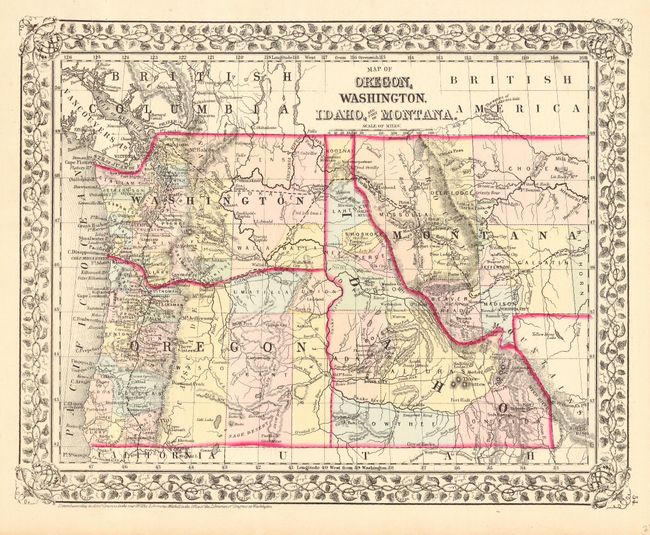
2) Map of Oregon, Washington, Idaho, and part of Montana, S.A. Mitchell, 1872 (13.5" x 10.8") clean and bright example (A+). The states and territories show their final boundaries except for Idaho, which loses a portion of the Island Park area to the future Wyoming, here simply labeled Untains.
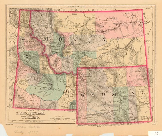
3) Gray's Idaho, Montana and Wyoming, F.A. Gray, 1878 (14.8" x 12") evenly and attractively toned with some marginal spots and chipping in lower margin ( B). Well engraved and detailed map of the region. Names two early railroads including the Union Pacific in southern Wyoming, and an unnamed spur in eastern Idaho extending north to Eagle River (Idaho Falls). Fine map of Utah on verso.
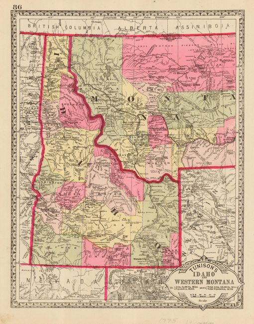
4) Tunison's Idaho and Western Montanaa", H.C. Tunison, 1885 (9.8" x 12.4") clean and bright impression with bright original hand coloring (A+). Very finely engraved with excellent detail throughout the states. The importance of mining is evident from the size of mining communities such as Rocky Bar and Idaho City.
References:
Condition: B
All with full original coloring. All encapsulated in archival Mylar.