Subject: United States - Northwestern
Period: 1827 (published)
Publication: Atlas Universel
Color: Hand Color
Size:
20 x 18 inches
50.8 x 45.7 cm
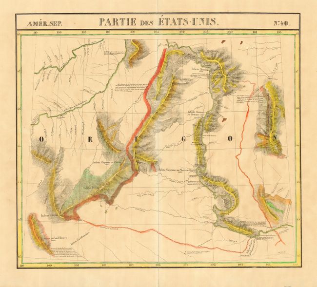
Important and very unusual map of part of Montana (labeled Oregon [Territory]) with great detail of the Missouri and Yellowstone Rivers. The map incorporates information from the explorations of Verendrye, Trudeau, Dorion, Hunt and Lewis & Clark. Several Indian tribes are located (along with their population). There are no towns or settlements shown, although it locates Fort Mandan. The Atlas Universel contained 400 lithographed maps in 6 volumes. It was the first atlas to present all the maps on the same scale (1: 1,641,836), with each map covering an area of approximately 20 degrees longitude (from Paris) and 6 degrees of latitude. Also considered to be the first lithographic atlas ever published. Of these large scale and highly detailed maps, Wheat said "No mapmaker had previously attempted to use such a large scale for any western American area." There was only one edition, published in 1825-27, and the subscription list shows that 810 copies were sold. A very nice example of a scarce map.
References:
Condition: A
Lovely impression and original hand coloring on a full sheet with very wide margins. A little very light scattered toning, still very good. Map is encapsulated in archival Mylar.