Catalog Archive
Auction 111, Lot 162

"[Reproduction] Map of Oregon and upper California From the Surveys of John Charles Fremont and other Authorities", Fremont, John Charles

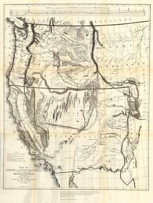
Subject: United States - Western

Period: 1900 (circa)

Publication:

Color: Black & White

Size:
19.8 x 25 inches
50.3 x 63.5 cm
Download High Resolution Image
(or just click on image to launch the Zoom viewer)

This is an early 20th century reproduction (photo-zincographic) of one of the most influential mid-nineteenth century map of the United States territory west of the 105th meridian. This map was a synthesis of information from a number of western explorers and showed for the first time the Mormon settlements in Utah. It also named for the first time the Golden Gate and was a significant map of the new California Gold Regions of California. The original is difficult to obtain in good condition and sells in the range of $1500-2000. This map was published by the British Ordinance Survey Office.

References:

Condition: B

Faint toning on folds. Two 1" binding tears and a couple of fold intersection splits repaired with archival tape.

Estimate: $80 - $120

Sold for: $50

Closed on 6/8/2005

Archived