Catalog Archive
Auction 111, Lot 156

"Map of Kansas and Nebraska", General Land Office

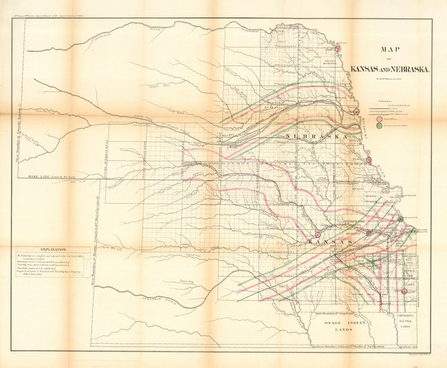
Subject: Central United States

Period: 1866 (published)

Publication: Annual Report of General Land Office, 39th Cong., 1st Sess.

Color: Hand Color

Size:
28 x 22.5 inches
71.1 x 57.2 cm
Download High Resolution Image
(or just click on image to launch the Zoom viewer)

A colorful and interesting map outlining the Railroad Grant Limits as authorized by Congress in 1864. Locates and names the A.T. & Santa Fe plus a branch, the Union Pacific and Omaha Branch Union Pacific railroads. Also noted are boundaries of numerous Indian Reservations, forts, watershed and survey progress. Legend and coloring locates railroad land grants, the 10, 20 & 25 miles limits, land offices and the Surveyor General's Office at Fort Leavenworth. A rarely seen issue.

References:

Condition: B

Issued folding, now pressed and backed with archival tissue. Toned along a few folds, one heavier than the rest.

Estimate: $150 - $200

Sold for: $110

Closed on 6/8/2005

Archived