Subject: Central United States
Period: 1861 (circa)
Publication: Illustrated Family Atlas
Color: Hand Color
Size:
16.5 x 12.5 inches
41.9 x 31.8 cm
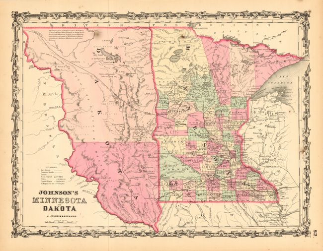
An attractive early map of Minnesota, about three years after statehood and showing approximately 63 counties and a few early railroads. An early depiction of Dakota Territory with only two regions shown by coloring and with the western boundary along the Missouri River. Numerous interesting notes, such as "The Vast Region of Prairie from Red River of North and Mini Walcan L. to about the Gr. Bend of the Missouri River is the Great Hunting Ground of Dakota, Ojibwe, Assiniboin, Arikcara, Minitarree and other Nations." Decorative border of the early steel engraved Johnson maps.
References:
Condition: A
Two small burn-like stains, else fine.