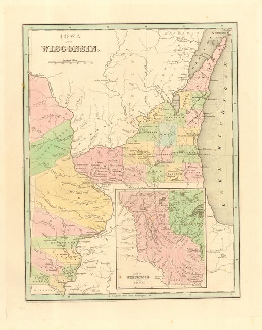
Subject: Central United States
Period: 1838 (dated)
Publication: Illustrated Atlas
Color: Hand Color
Size:
11.2 x 14.3 inches
28.4 x 36.3 cm
Scarce, early copper engraved map that also includes today's Minnesota. The map extends from Missouri's northern border well into Canada and east to the middle of Lake Michigan. The named counties in Iowa are Van Buren, Lee, Henry, Des Moines, Louisa, Musouetin, Cook and Dubuque, with Indian lands to the north. Wisconsin is largely unsettled with only 16 counties names. The large inset, based on Nicollet, details the lands of the Dahcota or Sioux, Chippeways, Fox, Iowa, and Saulk Indians, and the watershed of the Missouri and Mississippi Rivers. Early information on forts, rapids, portages, etc. An important map that is the likely the first appearance of these new territories in a commercial atlas, issued the same year in which Iowa became a territory, and only two years after Wisconsin become a territory in 1836. This map is from the first edition of this rare atlas, which was published in a few editions between 1838 and 1845. Larger and more attractive format than seen in his more common Comprehensive Atlas.
References:
Condition: A
Good impression and original coloring. A couple light spots, still very good.


