Subject: Central United States
Period: 1834 (circa)
Publication: HR Doc 323, 23rd Congress, 1st session
Color: Hand Color
Size:
19 x 15.4 inches
48.3 x 39.1 cm
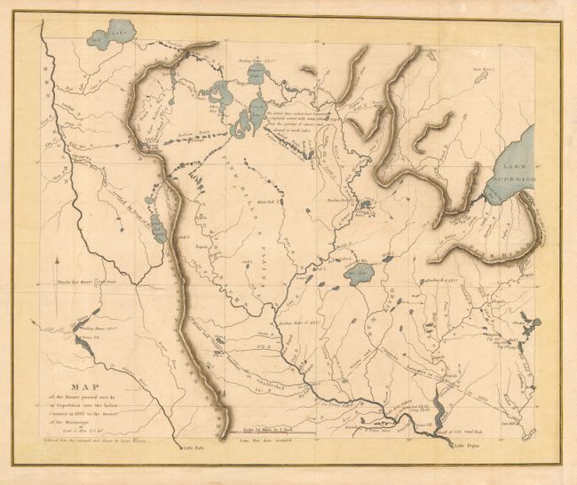
Scarce and important map issued to accompany the report by Schoolcraft and Allen. The map covers the region of present-day Minnesota from the western tip of Lake Superior to the Red River. It depicts Ft. Snelling, scores of Sioux villages, American Fur Company trading posts, and many other fascinating details. Henry Schoolcraft led the expedition into the upper Mississippi valley to attempt a reconciliation between the Sioux and Chippewa, and to vaccinate the Chippewa Indians. In the process he found time to search for the headwaters of the Mississippi, which led him to its source in Lake Itaska - noted here at Lat. 47.10' Lon. 95.54' (lake not named). Complete with the interesting 68 page report.
References: Claussen & Friis #28; Phillips (M) p. 440 #5; Sabin #77847.
Condition: B
Tissue and archival tape reinforced folds and repair of a 2" binding tear at right. Couple of edge tears not affecting map. Later color. Some edge chipping of report, with slight loss of text on first few pages.