Subject: Italy
Period: 1620-1639 (circa)
Publication:
Color: Black & White
Size:
19 x 15 inches
48.3 x 38.1 cm
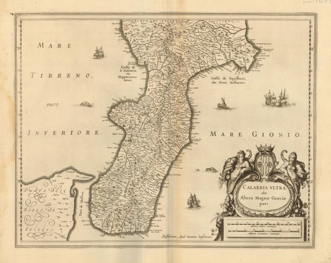
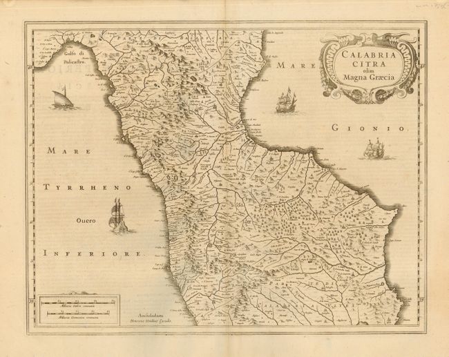
Two 16th Century maps of this beautiful and remote portion of Italy. The former, by Jansson, circa 1639, is a beautifully engraved chart covering the southern most portion of Calabria with just the tip of Sicily shown. Adorned with a decorative cartouche with two allegorical female figures holding horns of plenty, and sailing ships, sea monsters, and a galley ship. The latter is by Hondius, circa 1620. This map covers the northern part of Calabria from the Golfo di Policastro south to the Capo Colonna. Three sailing ships and a galley under full sail with the oars blocked up. A very nice pair of charts of this region.
References:
Condition: A
Both with nice impressions and good original margins. Both are surrounded on one or more sides with additional paper professionally laid in for inclusion in a composite atlas. Touch of centerfold toning on former, else very good.