Catalog Archive
Auction 110, Lot 314
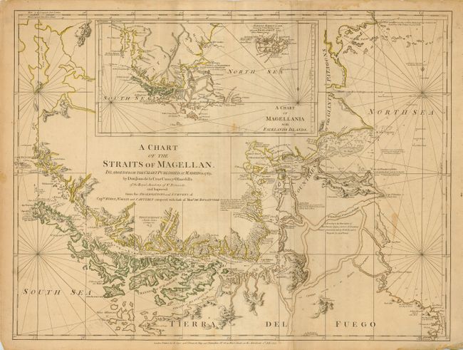
"A Chart of the Straits of Magellan. Inlarged from the Chart Published at Madrid in 1769 by Don Juan de la Cruz Cano y Olmedilla…", Jefferys/Sayer & Bennett
Subject: South America - Southern
Period: 1775 (dated)
Publication:
Color: Hand Color
Size:
27 x 20 inches
68.6 x 50.8 cm
Download High Resolution Image
(or just click on image to launch the Zoom viewer)
(or just click on image to launch the Zoom viewer)