Subject: Caribbean
Period: 1737 (published)
Publication: The English Pilot
Color: Black & White
Size:
31.2 x 18 inches
79.2 x 45.7 cm
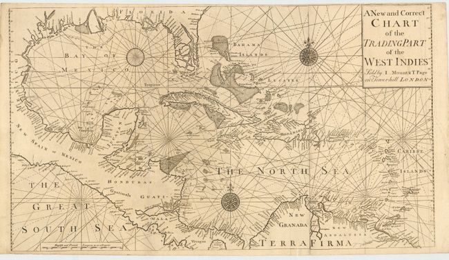
Scarce chart of the West Indies from the Bahamas to Trinidad, the Gulf coast, part of Mexico, Central America and the northern coast of South America. The Florida peninsula is depicted as several large islands. The map provides excellent coastal and navigational information and no interior details. The handsome chart includes three compass roses and rhumb lines. The English Pilot was one of the most important British publications. It was first published by John Seller in 1671 and went through many editions until 1803 through a succession of publishers. This important two-sheet chart was issued in the 1737 edition published by Mount & Page.
References:
Condition: A
Couple of insignificant paper flaws and a bit of light soil and creasing. Narrow top margin as issued.