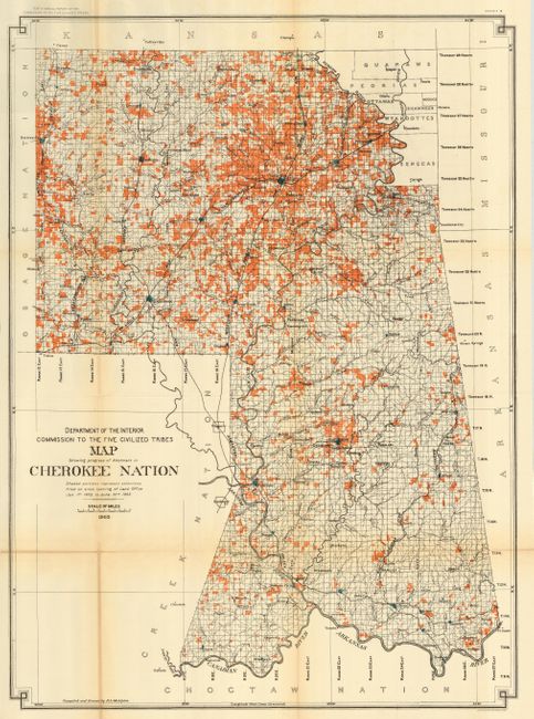
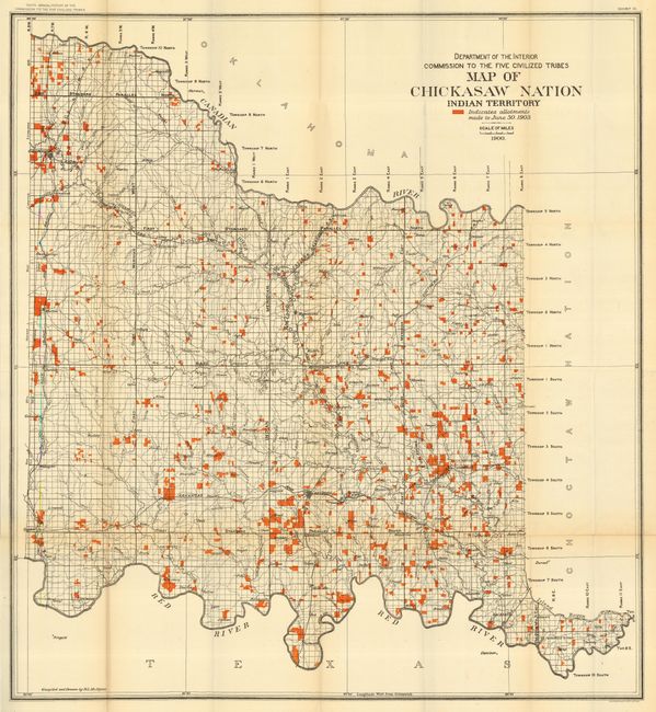
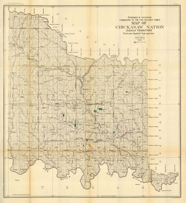
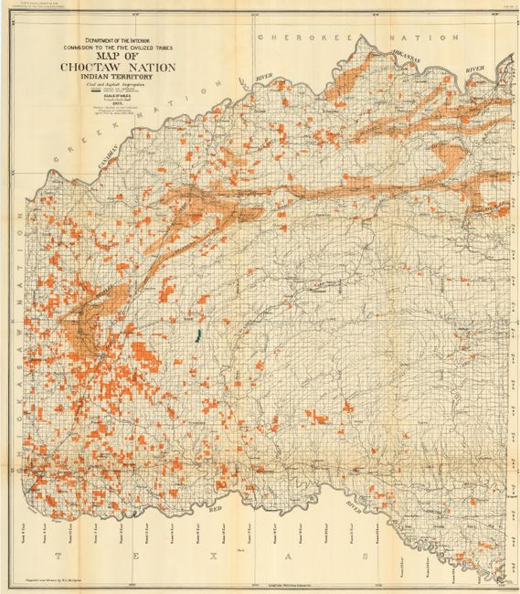
Subject: Oklahoma
Period: 1903 (published)
Publication: Commission to the Five Civilized Tribes
Color: Printed Color
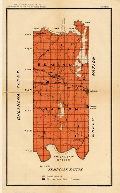
Five maps showing land allotments in detail for individual 'Civilized' Indian tribes, all printed by Bien. The maps were published by the Interior's "Commission to the Five Civilized Tribes" and were included in their Tenth Annual Report. Maps include: 1) Map Showing Progress of Allotment in Cherokee Nation, 26" x 35"; 2) Map of Chickasaw Nation Indian Territory, 30" x 33"; 3) Map of Chickasaw Nation Indian Territory Coal and Asphalt Segregation, 30" x 33"; 4) Map of the Chocktaw Nation Indian Territory Coal and Asphalt Segregation, 32.5" x 37"; 5) Map of Seminole Nation, 9.4" x 15.2". The first four map are compiled and drawn by R.L. McAlpine. A wonderful set of matching maps of Indian Territory just four years before the formation of the state of Oklahoma.
References:
Condition: A
Condition varies from very good to good. Some having a couple of tiny splits on fold. The Seminole Nation map has short splits and is toned along one fold - condition B.