Subject: New York
Period: 1895 (dated)
Publication:
Color: Printed Color
Size:
26.5 x 23 inches
67.3 x 58.4 cm
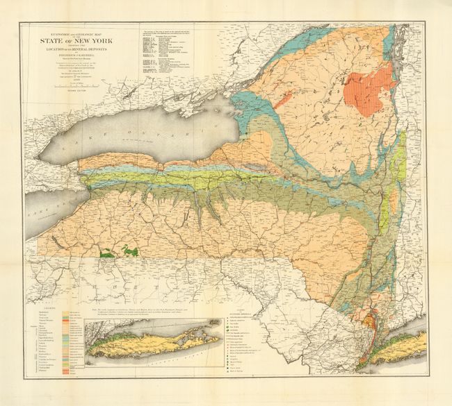
A colorful and comprehensive map of the state prepared to accompany a report on the "Mineral Exhibit of New York at the World's Colombian Exposition." Map by Frederich J.H. Merrill, Director of the New York State Museum. The geology of the map was based on an Agricultural and Geological report of 1844 with additions and corrections from numerous sources that are listed in a table. One legend explains symbols used to show the locations of water resources, gas and oil fields, clay deposits and stone quarries, etc. Another legend identifies 25 different geological types through coloring.
References:
Condition: A
Issued folding, now pressed and backed with archival tissue. Hint of toning along a fold.