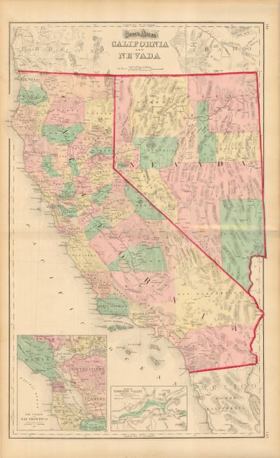
Subject: California and Nevada
Period: 1873 (dated)
Publication: Atlas of the United States
Color: Hand Color
Size:
25.2 x 15.5 inches
64 x 39.4 cm
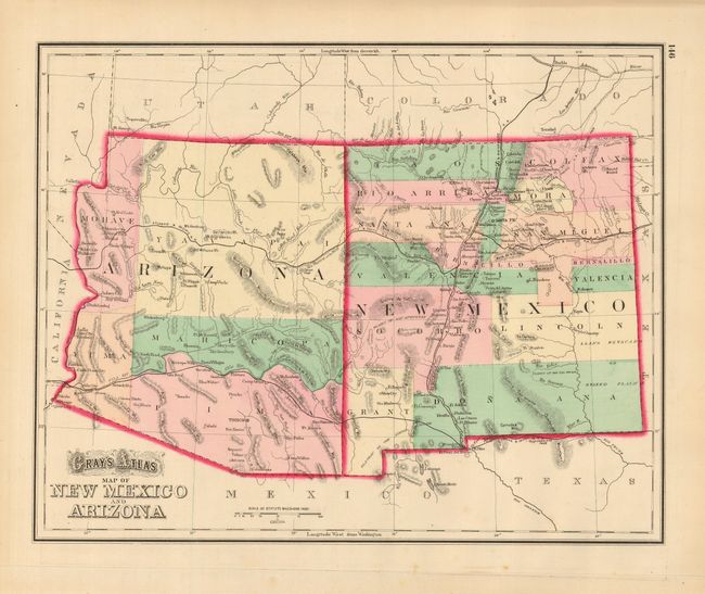
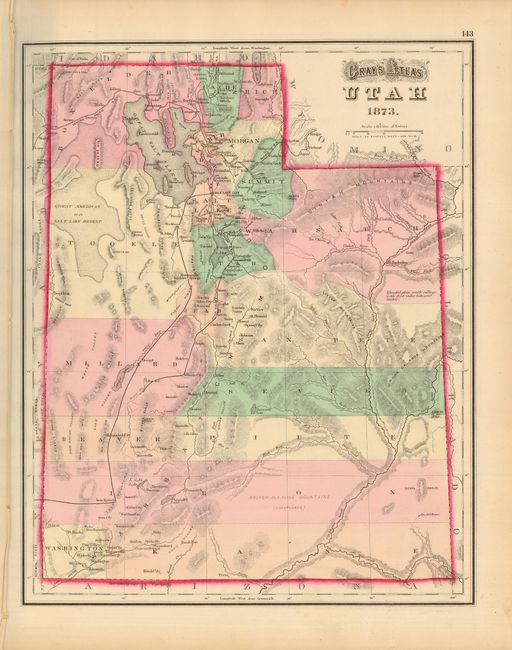
Great double-page map showing numerous named railroads, cities and towns, watershed, forts, and more. Two large insets: The Vicinity of San Francisco and Map of the Yosemite Valley. Early county development in the south with a huge San Bernardino Country extending nearly across the state and stopped from reaching the Pacific only by a narrow strip of Los Angeles County. Early railroad development with the lines ending at Bakersfield and Redding in the interior valley. Railroads along the coastal mountains extend north to Cloverdale and south to below Hollister and another spur to Soledad. On verso are two full-page maps: Gray's Atlas Map of New Mexico and Arizona, and Gray's Atlas Map of Utah. The Arizona sheet is a scarce configuration that adds a large Maricopa County as the fifth county and shows Tucson as the capitol. Both of these maps on the verso are in fine condition.
References:
Condition: A
A few very minor spots, else fine.