Subject: California
Period: 1855 (dated)
Publication: U.S. Pacific Railroad Surveys
Color: Black & White
Size:
23.3 x 27.5 inches
59.2 x 69.9 cm
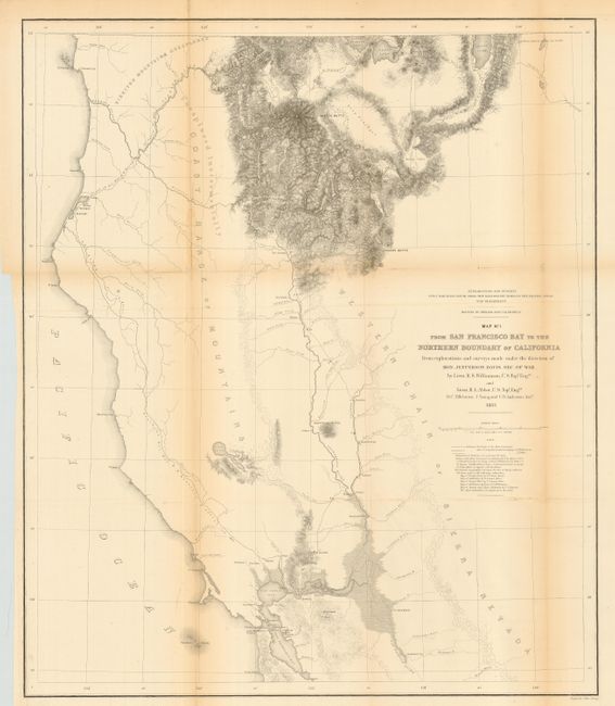
This map is quite detailed from Red Bluffs and north with place names, watershed and fine hachure in the mountainous areas. The balance of the map is mostly in skeletal format. Locates the Emigrant Trail plus the earlier explorations of Warner and Williamson in 1849, and Wessell in 1852. Notes the place Warner was killed in 1849. An area to the west is noted as Not Explored Instrumentally. Extends to show all of San Francisco Bay. Topography on the map was not added by this survey but taken from numerous sources including Fremont's "Map of Oregon and Upper California."
References: Wheat (TMW) #881.
Condition: B
Issued folding, now pressed and backed with archival tissue, with repairs of holes on folds. Toned along folds.