Subject: Germany & Poland
Period: 1824 (published)
Publication: A New General Atlas
Color: Hand Color
Size:
11.3 x 8.5 inches
28.7 x 21.6 cm
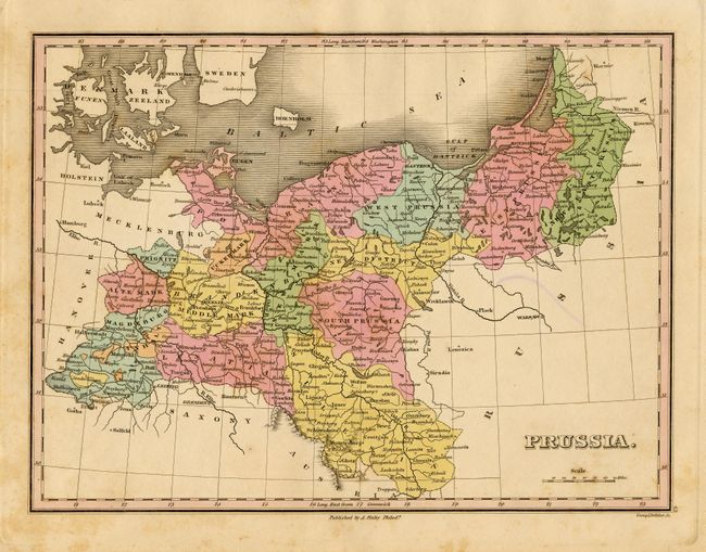
Finely's maps employ a delicate and elegant engraving style and provided extensive topographical and watershed information. He was the dominant map maker in the United States in the early 1820s into the 1830s. His atlases were very successful, outselling rival atlases by Carey & Lea, and Tanner. His maps were printed on high quality paper and were routinely corrected and updated.
This is a well engraved map that details the region and locates scores of towns and villages. Includes West, South and East Prussia, and further east to include New East Prussia. Extends south to include all of Silesia. Finely engraved by Young & Delleker.
References:
Condition: B
Fine pastel coloring and impression on thick paper. A little marginal foxing. Short ballpoint pen mark on verso with diffused show-through in blank area of map, still very good.