Subject: Massachusetts
Period: 1883 (dated)
Publication:
Color: Printed Color
Size:
21 x 30 inches
53.3 x 76.2 cm
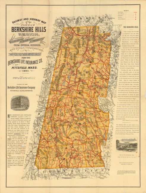
Published by Walter Watson for the Berkshire Life Insurance Company, Pittsfield, Mass. The map details the railways and highways of the Berkshire Hills region in 1883. Remarkable detail throughout including a legend identifying Main Roads, School Houses, Cemeteries, Churches, Railroad Stations, and much, much more. The map "is a prize of the Harvard Map Collection exhibit. This map is widely regarded as the first free road map ever distributed...mainly for touring bicyclists." Harvard University Gazette, Oct. 24, 2002. A noteworthy and seldom seen map that needs some professional conservation.
References:
Condition: B
Excellent color and impression on fine, banknote paper. Numerous long splits on some of the folds, else the map is near fine. Splits should be professionally closed.