Catalog Archive
Auction 109, Lot 187

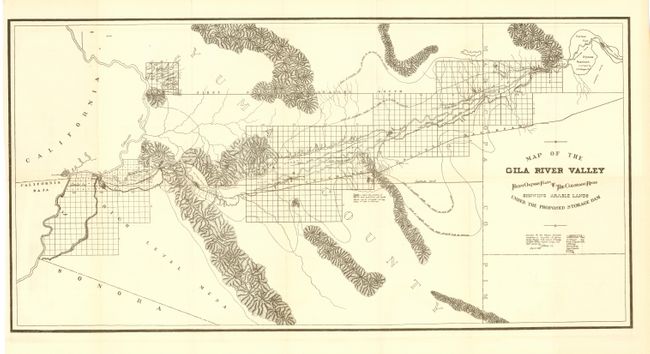
"Map of the Gila River Valley From Oatman Flats to The Colorado River Showing Arable Lands Under the Proposed Storage Dam", Anon.

Subject: Arizona

Period: 1889 (dated)

Publication:

Color: Black & White

Size:
29 x 14.5 inches
73.7 x 36.8 cm
Download High Resolution Image
(or just click on image to launch the Zoom viewer)

This chart was prepared for the Citizens Executive Committee on a proposed reservoir and irrigation of Yuma County, in August, 1889. Terrific detail along the Gila River including surveyed townships and topography. Lines show the limits of irrgated lands at different water levels in the proposed reservoir. A rare and fascinating piece of Arizona history that is in remarkable condition. We find no sales records for this map from any source.

References:

Condition: A+

Fine impression on clean paper. Folding, as issued.

Estimate: $200 - $250

Sold for: $160

Closed on 12/1/2004

Archived