Catalog Archive
Auction 109, Lot 132

"Suite de la Carte Reduite du Golphe de St. Laurent Contenant les…", Bellin, Jacques Nicolas
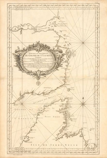
Subject: Canada

Period: 1753 (dated)

Publication: Hydrographie Francoise…

Color: Black & White

Size:
21.2 x 34.7 inches
53.8 x 88.1 cm
Download High Resolution Image
(or just click on image to launch the Zoom viewer)

Superb large-scale sea chart covering the coasts of Labrador and Newfoundland with the Strait of Belle Isle and part of the Gulf of St. Lawrence in great detail. The chart is dominated by the huge decorative title cartouche, a compass rose and loxodromic lines. The seal of the Depot de Marine is below the cartouche with Prix. trente Sols at bottom neatline, indicating a later issue, circa 1793.

References: Not in Kershaw.

Condition: B

Small repaired hole on centerfold and a few repaired marginal tears.

Estimate: $375 - $450

Sold for: $220

Closed on 12/1/2004

Archived