Subject: North America
Period: 1690 (dated)
Publication: Carte Generales de toutes les parties du Monde
Color: Hand Color
Size:
22.2 x 16 inches
56.4 x 40.6 cm
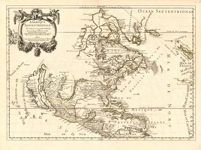
This map replaced Nicolas Sanson's landmark map of 1650 in this atlas. Guillaume Sanson, in partnership with Pierre Mariette, based this map on his father's 1666 wall map of North America. Cartographically it is an amalgam of Sanson's maps of "Le Canada, ou Nouvelle France" and "Le Nouveau Mexique, et La Floride". Lake Erie is shown in a recognizable form and the entire Great Lakes network is shown in greater detail, although still with the western lakes open-ended. On the East coast, Long Island is shown and the shape of the Outer Banks is improved. The island of California is now shown in the form originating with Luke Foxe's map of 1635, and popularized by Sanson. Several Indian tribes are identified in New Mexico where the R. del Norte (Rio Grande) mistakenly flows from an interior lake and empties into the Mar Vermeio ou Mer Rouge (Gulf of California). Iceland now appears in the Atlantic, as well as a bit of Britain. Second state with the addition of N. Yorc, Terre de Iesso, Conibas and Detroit d' Anien.
References: Burden #404; Tooley (Amer), p. 114; and McLaughlin #45.
Condition: A
Expert and nearly invisibly filled worm tracks at sides with a few lines of skilled facsimile. Noticeable only on very close inspection.