Subject: Reference Books
Period:
Publication:
Color:
1) "Five Centures of Map Printing" edited by David Woodward, University of Chicago Press, 1975. A series of essays from lectures comprising the Third Series of Kenneth Nebenzahl, Jr., Lectures in the History of Cartography at the Newberry Library (1972). The authors, all renowned in the field of cartography, provide an excellent treatise of the various printing techniques used in map making, from woodcut to offset lithography. 177 pp., color frontispiece & 37 monochrome illustrations. Hardbound in library buckram.
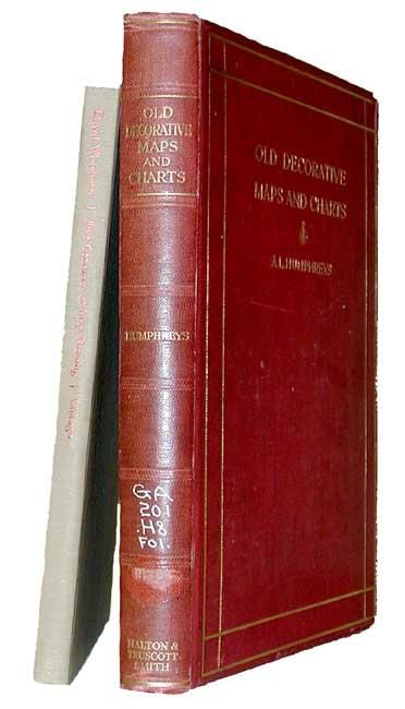
2) "Old Decorative Maps and Charts" by Arthur L. Humpreys, Halton & Truscott Smith Ltd., 1926, First Limited Edition #285/1500. An excellent and sought after reference compiled from maps in the MacPherson Collection, one of the finest collections in existence. Seventy-nine maps are reproduced, including 18 full-color (1 folding) tipped in, and a catalogue of atlases 1482-1776. Hardbound in gilt embossed, red cloth boards.
References:
Condition: A
First fine. Second ex-lib with numbers on spine and rubber stamps verso of title page and bottom of contents page.