Subject: Iceland
Period: 1644 (circa)
Publication:
Color: Hand Color
Size:
19.5 x 15 inches
49.5 x 38.1 cm
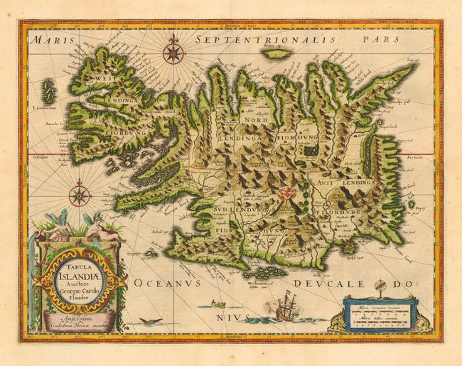
Fabulous map of Iceland with numerous embellishments including tall mountains and volcanoes filling the island, two compass roses, sea creatures, a sailing ship and fine title and scale of miles cartouches. This map has a rich cartographic history. It was originated by Joris Carolus, a Dutch sailor, who based it largely on the work of Bishop Gudbarndu Thorlaksson. It was first issued by Jodocus Hondius and then re-issued by Willem Blaeu with his imprint. It became the prototype for the mapping of Iceland and its influence did not wane until the mid-18th century. Latin text on verso.
References:
Condition: A
Superb impression with fine later color. Full wide margins with a couple of insignificant spots.