Catalog Archive
Auction 108, Lot 283

"Carte Reduite de l'Ocean Occidental Contenant Partie des Costes d'Europe et d'Afrique depuis le 51e, Degre de Latitude Septentrionale jusqu a l'Equateur et celles de l'Amerique qui leur sont opposees…", Bellin, Jacques Nicolas

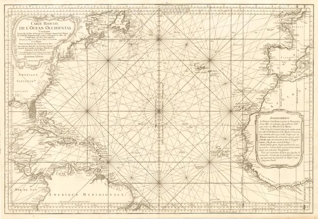
Subject: North Atlantic Ocean

Period: 1766 (dated)

Publication:

Color: Black & White

Size:
34.7 x 23.5 inches
88.1 x 59.7 cm
Download High Resolution Image
(or just click on image to launch the Zoom viewer)

Handsome, large sea chart of the Atlantic Ocean, north of the equator, delineated with rhumb lines. A good portion of each of the continents is shown with major port cities named. The coast of North America is labeled with the colonies and Florida is shown as a mass of islands. Two large, decorative cartouches fill the interior in North America and Africa. This is the fourth updated edition of a map originally produced in 1738 for the Ministre de la Marine.

References:

Condition: A+

Fine impression.

Estimate: $800 - $1,000

Sold for: $600

Closed on 9/29/2004

Archived