Catalog Archive
Auction 108, Lot 274

"An Accurate Map of Paraguay, Tucumania, Chaco, Rio de la Plata &c. With part of Brasil from 20 to 37 Degrees South Latitude", Bowen, Emanuel

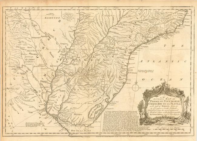
Subject: Central South America

Period: 1746 (circa)

Publication:

Color: Black & White

Size:
16.5 x 11.2 inches
41.9 x 28.4 cm
Download High Resolution Image
(or just click on image to launch the Zoom viewer)

An interesting copper engraved map showing considerable detail throughout the region. Locates scores of rivers and numerous towns and villages. A long notation discusses the Jesuit settlements in Paraguay and notes that the native population of about 300,000 families has been reduced into a "State of absolute Subjection and Slavery to their present Tyrannical masters the Jesuits." Simple compass rose and decorative cartouche.

References:

Condition: B

On thick hand-laid paper, folding as issued. Tiny holes at fold intersections and very light occasional foxing, else very good.

Estimate: $120 - $140

Sold for: $70

Closed on 9/29/2004

Archived