Catalog Archive
Auction 108, Lot 267

"[Lot of 4] Praefecturae de Paraiba, et Rio Grande [and] Praefecturae Paranambucae pars Borealis… [and] Praefecturae Paranambucae pars Meridionalis [and] Praefectura de Ciriii, vel Seregippe Delrey cum Itapuama", Blaeu, Johannes
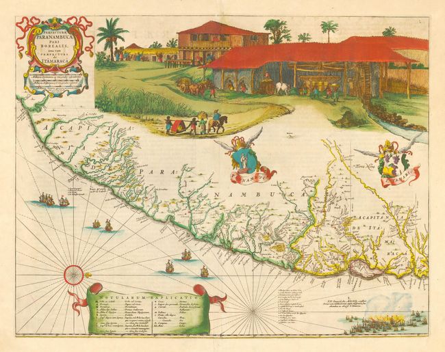
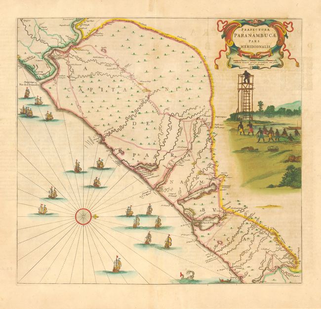
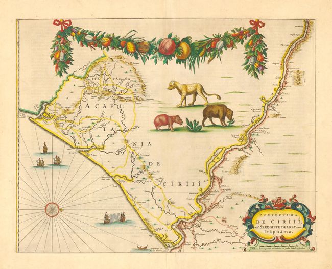
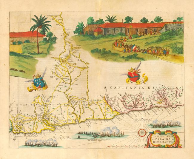
Subject: Brazil

Period: 1662 (published)

Publication: Atlas Maior

Color: Hand Color

Size:
21.2 x 16.5 inches
53.8 x 41.9 cm
Download High Resolution Image
(or just click on image to launch the Zoom viewer)

Superb, rare matching set of maps covering the Brazilian Capitanias. These maps were drawn after actual surveys by Georg Markgraf, Elias Herckmanns and others and were among the first maps of Brazil based on non-Portuguese data. In addition to the fine cartographic detail the maps are lavishly ornamented with cartouches, coats of arms, ships, sea battles, wildlife, and impressive scenes illustrating local life, fishing, and sugar manufacturer. The four maps of the capitanias of Brazil are unlike any other maps in Blaeu's atlas. They were first issued in 1647 for Gaspar Barleus' Rerum per octennium in Brasilia, one of the greatest sources for Brazilian history. This set is from the first atlas edition with Latin text on verso.

References: Goss (Blaeu) p. 184-185; Van der Krogt (Atlantes) #9850.

Condition: B

Superb original color. Very good except for some light toning and offsetting. Professional repairs on folds and in blank margins.

Estimate: $3,000 - $4,000

Sold for: $8,000

Closed on 9/29/2004

Archived