Catalog Archive
Auction 108, Lot 186

"The State of Florida Compiled in the Bureau of Topographical Engineers from the Best Authorities", U.S. War Dept.
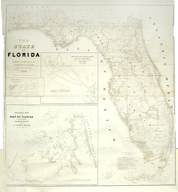
Subject: Florida

Period: 1846 (dated)

Publication:

Color: Black & White

Size:
40 x 41.5 inches
101.6 x 105.4 cm
Download High Resolution Image
(or just click on image to launch the Zoom viewer)

A very large and comprehensive map of Florida showing the status of Public Land Surveys, rivers, lakes, coastal islands, towns, army posts, trails etc. Inset maps: "Key West as surveyed February 1829"; "Mouths of Swanee R. and Cedar Keys showing the Western terminus of a proposed railroad"; and "A General Map of part of Florida included between Cedar Keys and St. John's River." This is an incredible map filled with detail. Drawn by J. Goldsborough Bruff and finely engraved by D. McClelland of the Topographical Engineers.

References:

Condition: B

Side borders trimmed for binding, as issued. Lightly toned along fold and a little offsetting, else very good.

Estimate: $700 - $900

Sold for: $1,100

Closed on 9/29/2004

Archived