Subject: California
Period: 1849 (dated)
Publication: Senate Ex Doc 18, 31st Cong 1st Sess.
Color: Black & White
Size:
19 x 24.8 inches
48.3 x 63 cm
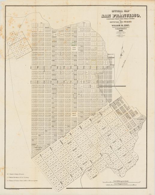
A scarce and seldom offered street map of San Francisco. Appears to be pre-landfill, with some planned tracts drawn in the bay. Terrific detail with individual tracts numbered and many streets named. Gives the location of the Yerba Buena Cemetery, a Government Reserve, two Public Squares and Fort Montgomery, but no buildings are shown. A coloring legend, at lower left, keys to the map and locates a grant to Senora Breouers, claims of the heirs of Col. J. A. King and a claim of Senor Pana under a Mexican Grant. Attributed by Howes to the report "Land Titles in California" by William C. Jones. Howes notes that not all copies had this map. A rare and early city plan that was drawn by S. W. Higgins and printed by C.B. Graham.
References: Howes #248.
Condition: B
Issued folding, now backed with tissue. Upper right with a little foxing, else very good.