Subject: Alaska
Period: 1869-98 (dated)
Publication:
Color:
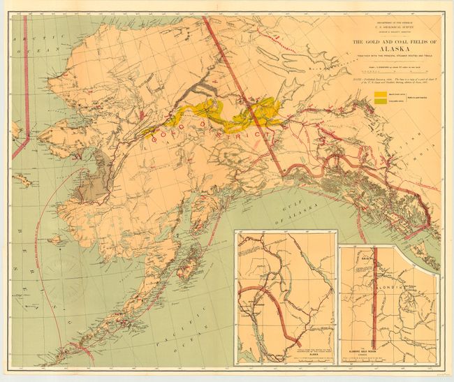
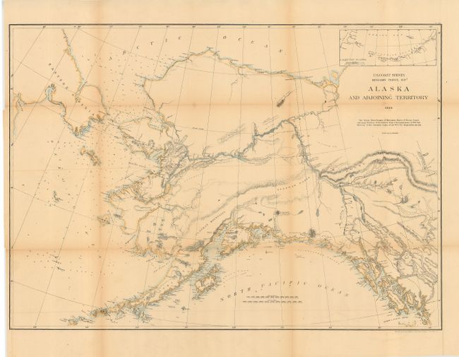
First is a fine geological map printed by the five-color lithographic method with considerable place name detail. The Birch Creek and Forty Mile gold regions are prominently shown. There are two insets: "Trails from the tide water to the headwaters of the Yukon River, Alaska" and "The Klondike Gold Region, Canada." Monthly steamer routes are shown servicing areas from Norton Sound, along the south side of the Aleutians and along the Alaskan Coast to San Francisco. One of the great maps of the Alaskan Gold Rush. Dated 1898 (28.5 x 23.5"). The second map is from U.S. Coast Survey, Benjamin Pierce, Supt. 1869. Hand colored (34 x 26"). This is a remarkably early and detailed chart that is possibly the first complete survey of the territory's coastline since the transfer of sovereignty from Russia in 1867. Many features of the interior were taken from W.H. Dall's 1865-68 W.U. Tel. Expedition.
References: First: Falk (AK) 1898-51; Phillips (AK) p. 117.
Condition: A
Former is in very good condition with fine coloring. Latter is in good condition with toning along folds, else very good. Both backed with archival tissue.