Subject: Western Hemisphere
Period: 1661 (published)
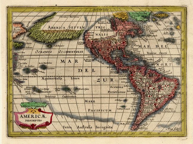
Publication: Introductionis in Universam Geographicam
Color: Hand Color
Size:
8 x 5.7 inches
20.3 x 14.5 cm
Abraham Goos engraved this fascinating map for Jansson's new Atlas Minor, first published in 1628, and in 1661 it appear in this popular geography by Philipp Cluver. The most dominant feature of the map is the curious depiction of the west coast of North America, which is completely bisected by an unnamed straight (Northwest Passage), possibly derived from reports of Juan de Fuca's disputed voyage. The bulging northwest coast of North America continues another 65 degrees and is separated from Asia by a narrow Fretum Anian. These features were derived from the Van den Keere and Plancius globe of 1614 and this is the first time they appear on a map of the Americas. Previous maps had depicted the supposed Northwest Passage through the Strait of Anian. Other interesting features include the St. Lawrence River flowing from a small lake in the west, no Great Lakes, and an area of shading in Virginia alluding to the possibility of a Verrazano-type inland sea.
References: Burden #221.
Condition: A+