Catalog Archive
Auction 106, Lot 89

"An Accurate Map of North America", Rollos, George

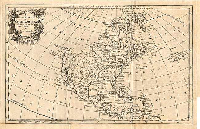
Subject: North America

Period: 1762 (circa)

Publication: Geographical Dictionary

Color: Black & White

Size:
11.6 x 7.4 inches
29.5 x 18.8 cm
Download High Resolution Image
(or just click on image to launch the Zoom viewer)

An English map based on the cartography of Robert de Vaugondy. Shows the British colonies extending to the Mississippi. Above California and New Albion is the Inlet discover'd by Martin d'Aguilar, and above that is labeled Parts Unknown. Decorative title cartouche with Native Americans and a crocodile.

References:

Condition: B

Folding as issued, with slight offsetting. Bottom margin extended.

Estimate: $200 - $250

Sold for: $150

Closed on 3/3/2004

Archived