Subject: Italy
Period: 1793 (dated)
Publication:
Color: Black & White
Size:
34 x 22.5 inches
86.4 x 57.2 cm
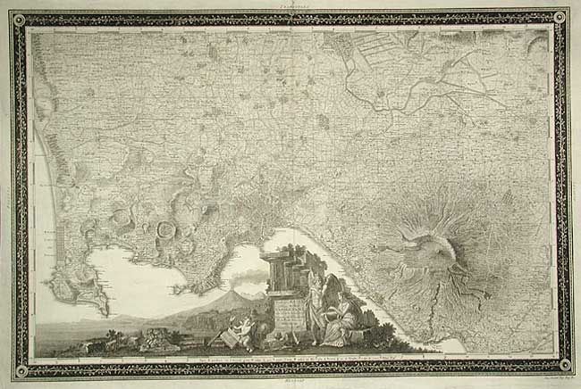
This grand and scarce map of the vicinity of Naples is one of the most beautiful examples of graphic cartography in the eighteenth century. It was the first modern map of the region and covers the region with minute detail right down to the individual farms. The topography, particularly of Mt. Vesuvius, is graphically shown. The entire Bay of Naples is filled with an incredible cartouche in landscape style filled with mythological figures. The map is surround in a beautifully engraved wide border. Rizzi-Zannoni was a noted astronomer, surveyor and mathematician and Geographer to the Venetian Republic.
References:
Condition: A
Rich impression, printed on very sturdy paper. Professionally reinforced centerfold with tiny bit of loss in top border and a couple of minor repairs, still very good.