Subject: Ancient World
Period: 1493 (published)
Publication: Liber Chronicarum
Color: Hand Color
Size:
17.1 x 12.1 inches
43.4 x 30.7 cm
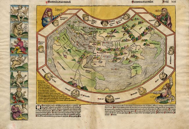
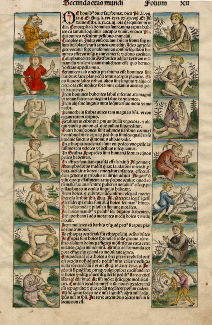
This great map was the last map to appear before the dissemination of Columbus' discoveries in the New World. The map was printed a mere forty year's after the invention of printing and is one of the earliest world maps available to the collector. Noah's three sons, Ham, Shem, and Japhet, hold the map up to view and the wide border includes the twelve winds with their Latin and Greek names. The map is in the typical Ptolemaic form with the Indian Ocean completely enclosed by land and a huge Toprobana (Ceylon). The source of the map was apparently the frontispiece of Pomponius Mela's Cosmographia (1488). At left is a panel of seven fantastic humanoid creatures reflecting the fertile imaginations of the Chronicle artists about the inhabitants of the remotest parts of the world. Two panels containing fourteen more monstrosities fill the verso along with Latin text. Some of these creatures are based on classical writings, while others were born of medieval traveler's tales. Overall size, including panel at left and text below is 20.2 x 14".
References: Shirley #19; Wilson, p.98-122.
Condition: B
Attractive period-correct color on both sides of sheet. Usual centerfold repair of binding holes with some toning and mild soil, else very good.