Catalog Archive
Auction 106, Lot 300
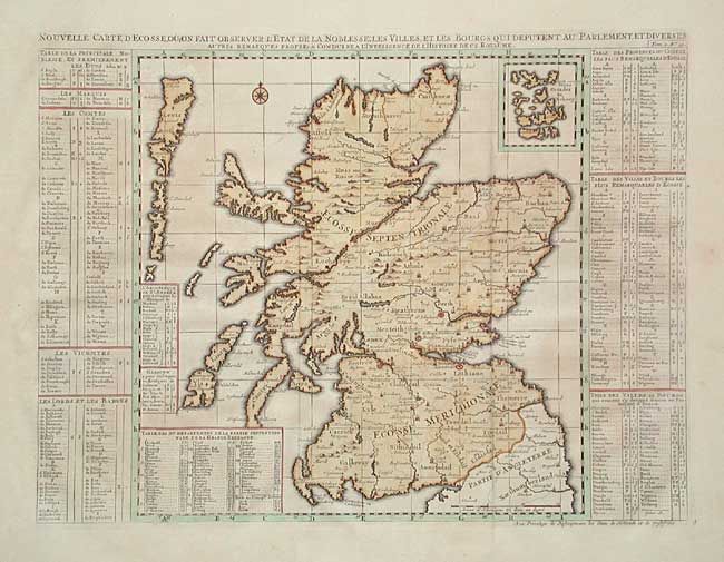
"Nouvelle Carte d'Ecosse, ou l'on Fait Observer l'Etat de la Nobles se: les Villes, et les Bourgs qui Deputent au Parlement, et Diverses…", Chatelain, Henry Abraham

Subject: Scotland
Period: 1719 (circa)
Publication:
Color: Hand Color
Size:
18.2 x 14 inches
46.2 x 35.6 cm
Download High Resolution Image
(or just click on image to launch the Zoom viewer)
(or just click on image to launch the Zoom viewer)

