Catalog Archive
Auction 105, Lot 92

"A New and Accurate Map of North America from the best Authorities", Carey, Mathew

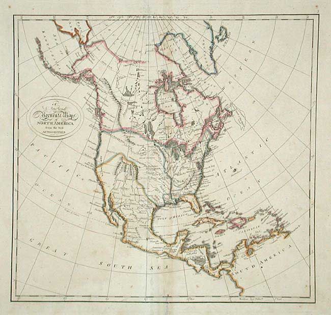
Subject: North America

Period: 1814 (published)

Publication:

Color: Hand Color

Size:
14.5 x 13.7 inches
36.8 x 34.8 cm
Download High Resolution Image
(or just click on image to launch the Zoom viewer)

Delicately engraved with minimal details. Extends to show the northern part of South America and all of the Caribbean. Texas is named and is part of a huge tract of land that extends to Canada and includes all of present-day California, Oregon and Washington. Alaska and Cook's River are located. The Columbia River is shown.

References:

Condition: B

Professional repairs to corners and along centerfold with some small areas of loss. Splits top and bottom centerfold, into map border. Scattered foxing and toned along centerfold.

Estimate: $150 - $200

Sold for: $210

Closed on 12/3/2003

Archived