Subject: World
Period: 1770 (published)
Publication: Atlas General…
Color: Hand Color
Size:
10.1 x 9 inches
25.7 x 22.9 cm
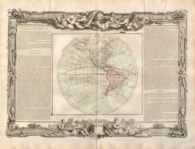
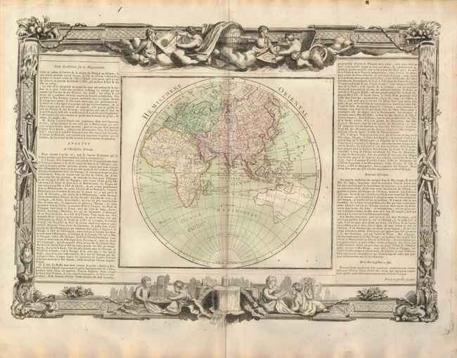
A handsome and fascinating pair of decorative maps. Issued during a time of controversy and confusion as to the true nature of the Pacific coast of North America. Desnos devised an interesting method to depict the conflicting theories. Philip Buache's concepts, including the mythical Mer de l' Ouest and B. de l' Ouest with its Northwest Passage, are engraved in faint hachures and colored in yellow. While the ideas of Gerhard Freidrich Muller, which includes the fabled River of the West connecting through a network of lakes into both Lake Superior and Hudson Bay, are shown by dotted line and colored green. There is no sign of Antarctica, the coastlines of New Zealand and Australia are indistinctly shown, while New Guinea and Tasmania are still connected to Australia. The oceans are filled with the tracks of the major explorations. Each is on a full sheet (22" x 17.5") with text panels at both sides, all surrounded by decorative borders that include scenes of putti, globes, instruments, etc.
References:
Condition: B
Good impression with nice original coloring. Both with a little toning at centerfold, else very good.