Catalog Archive
Auction 105, Lot 329

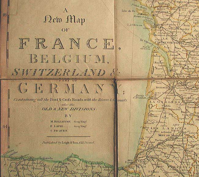
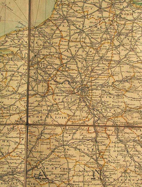
"A New Map of France, Belgium, Switzerland & part of Germany containing all the Post & Cross Roads, with the Rivers, & Canals, also the Old & New Divisions", Leigh, Samuel

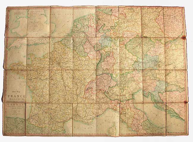
Subject: Western Europe

Period: 1825 (circa)

Publication:

Color: Hand Color

Size:
42.7 x 30.5 inches
108.5 x 77.5 cm
Download High Resolution Image
(or just click on image to launch the Zoom viewer)

Huge folding postal route map published by Leigh & Sons from the maps of Belleyme, Lapie and Picquet. It is an extremely detail map showing roads, canals, cities, towns, shipping lanes, political divisions, and topography. Dissected and linen backed, folding with paper backs with labels advertising Leigh's other maps.

References:

Condition: B

Toned with a few spots and short separations on a couple outside folds. Labels chipped, lacking slipcase.

Estimate: $200 - $250

Sold for: $150

Closed on 12/3/2003

Archived