Catalog Archive
Auction 105, Lot 23

"Mappe-Monde pour Connoitre les Progres & les Conquestes les Plus Remarquables des Provinces-Unies, ainsy que celles des Compagnies d'Orient et d'Occident, et les Pais quelles Possedent dans l'un et dans l'autre Hemisphere", Chatelain, Henry Abraham
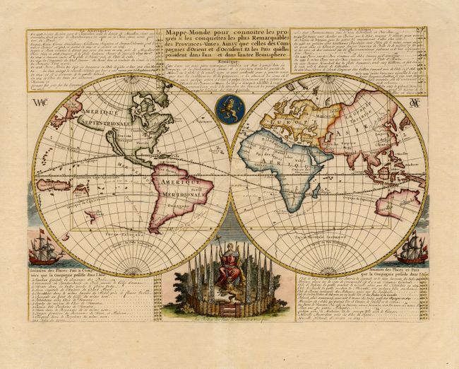
Subject: World

Period: 1705 (circa)

Publication:

Color: Hand Color

Size:
18 x 13 inches
45.7 x 33 cm
Download High Resolution Image
(or just click on image to launch the Zoom viewer)

Unusual double hemisphere map with California as an Island and incomplete coastlines of Australia and New Zealand. Dutch text describes the expeditions and colonial possessions of the Dutch East India Company. The map originated about 1670 and the plate was acquired by Chatelain who added the decorative elements, which include sailing ships, the Dutch crest, and a figure representing Europa seated inside a native fort. The information given on the map is an interesting commentary on the early spread of the Dutch colonial empire.

References: Shirley #447.

Condition: A

Dark impression and very nice coloring.

Estimate: $800 - $1,000

Sold for: $700

Closed on 12/3/2003

Archived