Catalog Archive
Auction 105, Lot 184

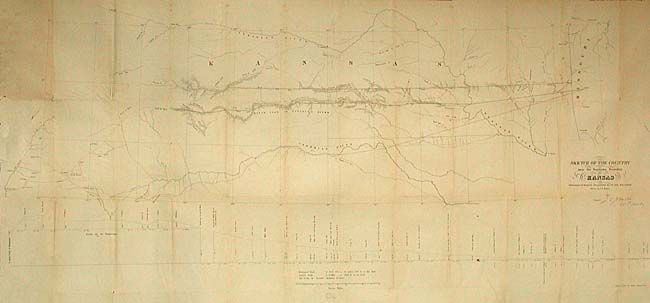
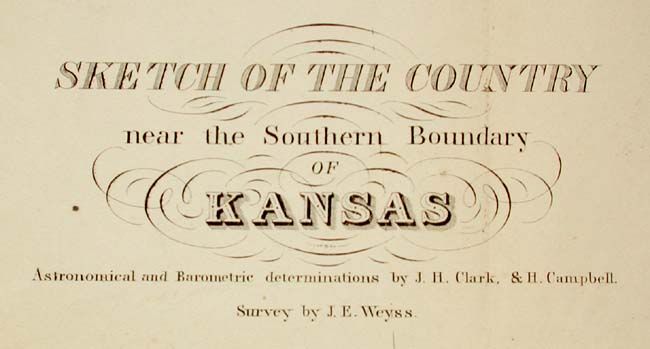
"Sketch of the Country near the Southern Boundary of Kansas", U.S. Government

Subject: Kansas

Period: 1857 (published)

Publication: HR Doc. 103, 35th Cong. 1st Sess.

Color: Black & White

Size:
48 x 21 inches
121.9 x 53.3 cm
Download High Resolution Image
(or just click on image to launch the Zoom viewer)

Map of the important survey that established the southern boundary of Kansas. Surveyed by J.E. Weyss and signed by J.E. Johnston, Col. 1st. Cavalry in the plate. The map includes topographic features and good detail with the locations of forts. Identifies the Santa Fe Trail as Santa Fe Road. Shows the route of Lt. Whipple in 1853 and Aubrey's Trail. At bottom is a profile of elevations by Dr. Wizlizenus.

References:

Condition: B

Issued folding, now backed with archival tissue. Lightly toned along some folds, else very good.

Estimate: $180 - $220

Sold for: $100

Closed on 12/3/2003

Archived