Subject: Canada and United States
Period: 1779 (circa)
Publication:
Color: Hand Color
Size:
12.5 x 8.5 inches
31.8 x 21.6 cm
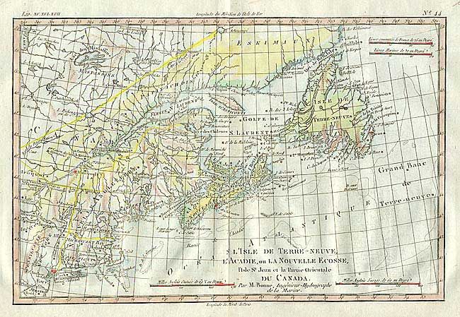
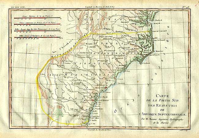
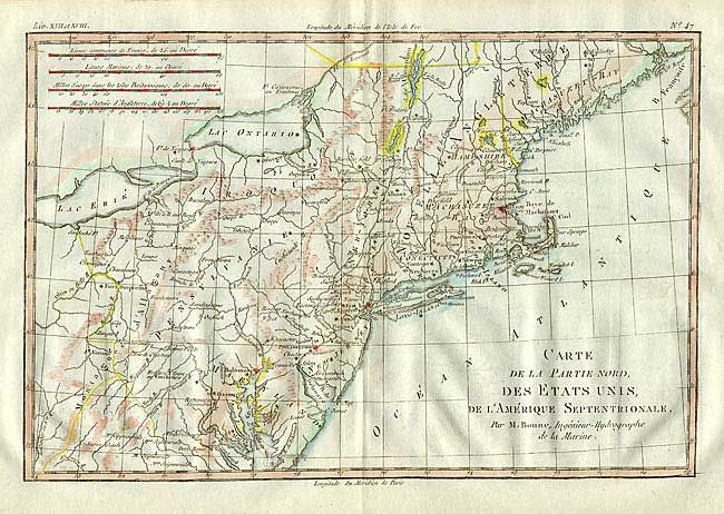
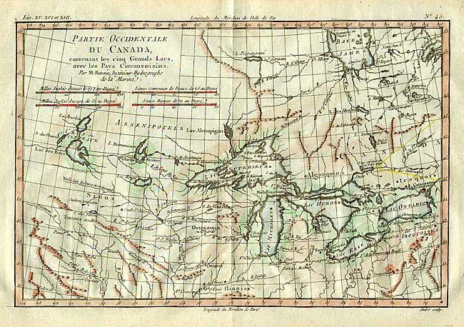
Nice group of copper engraved maps covering the eastern part of North America. 1) "Partie Occidentale du Canada, contenant les cinq Grands Lacs, avec les Pays Circonvoisins" covers the Great Lakes region and locates Chicago, Detroit and several other forts. 2) "Carte de la Partie Nord, des Etats Unis, de l' Amerique Septentrionale" covers the northeastern region from Chesapeake Bay to Maine and inland to Lake Erie. 3) "Carte de la Partie Sud des Etats Unis de l' Amerique Septentrionale" depicts the southeastern states. 4) "L' Isle de Terre-Neuve l' Acadie, ou la Nouvelle Ecosse, l' Isle St. Jean et la Partie Orientale du Canada" covers New England and the Canadian Maritimes. Size varies slightly. Engraved by Andre.
References: Sellers and Van Ee #173, #744, #1406 & 172.
Condition: A
Later color. Bit of faint offsetting that erases easily.