Catalog Archive
Auction 104, Lot 94

"A Map of the Whole Continent of America. Particularly Showing the British Empire in the Northern part of America, with the Divisions of the New Governments since the accession of Canada and Florida", Bowles

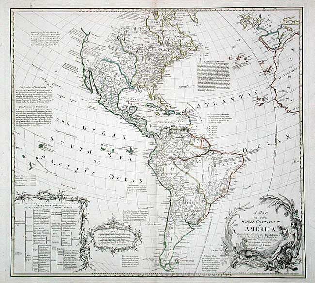
Subject: Western Hemisphere

Period: 1765 (circa)

Publication:

Color: Hand Color

Size:
21.5 x 19.6 inches
54.6 x 49.8 cm
Download High Resolution Image
(or just click on image to launch the Zoom viewer)

Very uncommon map of the Americas showing Britain in control of the entire eastern part of North America. The western part is labeled New Albion and both the Sea of the West and River of the West are named, but not delineated. The map includes a large key to the colonial possessions and is colored accordingly. The map is filled with interesting notations concerning discoveries, treaties, and cartographic misconceptions. Large title cartouche with an Amazon queen, cherubs, beaver and crocodile.

References:

Condition: A

Minor marginal flaws.

Estimate: $1,400 - $1,600

Sold for: $1,500

Closed on 9/10/2003

Archived