Catalog Archive
Auction 104, Lot 442

"Carte de la Souverainete de Neuchatel et Vallangin…", Covens & Mortier

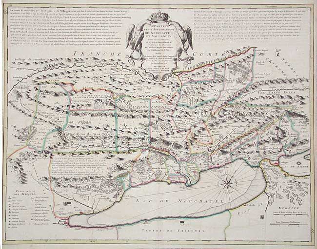
Subject: Switzerland

Period: 1733 (circa)

Publication:

Color: Hand Color

Size:
25.4 x 19.5 inches
64.5 x 49.5 cm
Download High Resolution Image
(or just click on image to launch the Zoom viewer)

Strongly engraved with good detail throughout. Extends to include Granson, Neuchatel, Cudresin and part of Lake Bienne. The map is based on geometrical observations by the Neunburg engineer David François de Merveilleux (1652-1712). Long text at top describes the area and its political relationships with nearby Cantons. Decorative cartouche, compass rose and fleur-de-lis.

References:

Condition: B

Crisp impression with original color. Light offsetting and lightly toned along centerfold, else very good.

Estimate: $275 - $325

Unsold

Closed on 9/10/2003

Archived