Catalog Archive
Auction 104, Lot 382

"Nouvelle Carte de la Mer Noire, et du Canal de Constantinople tres exacte…", Visscher, Nicolas
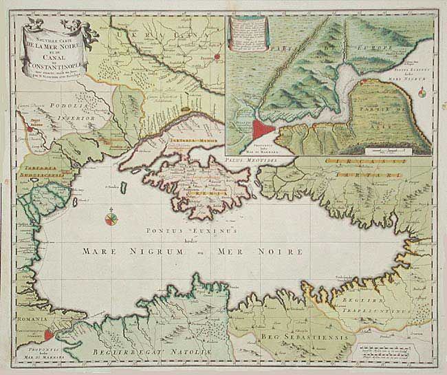
Subject: Black Sea

Period: 1680 (circa)

Publication:

Color: Hand Color

Size:
22.6 x 19 inches
57.4 x 48.3 cm
Download High Resolution Image
(or just click on image to launch the Zoom viewer)

Superb map of the Black Sea with a large inset of the Bosporus with Constantinople and its fortifications. Because of its strategic location, Constantinopole was central to the region’s trade routes, which linked Europe, Persia, the Arabian peninsula, the Horn of Africa, the Caucasus, the Russian steppe, the Balkans, and the Mediterranean Basin.

References:

Condition: A

Superb original color including three additional names in red color to note the Tartary possessions. Couple spots of candle wax in margins.

Estimate: $350 - $400

Sold for: $325

Closed on 9/10/2003

Archived