Subject: Atlantic
Period: 1700 (circa)
Publication: Atlas Maritimus
Color: Hand Color
Size:
20.5 x 17 inches
52.1 x 43.2 cm
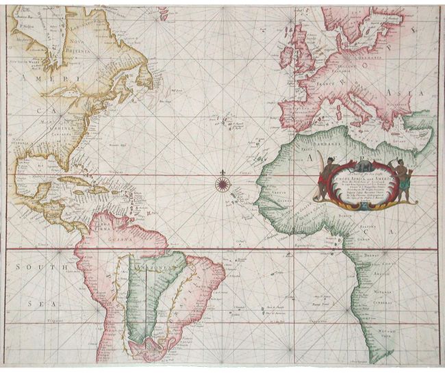
Scarce map centered on a compass rose in the Atlantic Ocean but including the coastlines of the surrounding continents in great detail. The southern part of South American is enclosed in an inset surrounded by a delicate garland. The elaborate cartouche, embellished with an elephant and two Africans, one holding an elephant tusk, emphasizes the pivotal role of Africa in the Atlantic trade network. John Thornton was appointed Hydrographer to the Hudson Bay Company and the East India Company and worked closely with several important English cartographers and publishers. Thornton's imprint at the Signe of the Platt in ye Minories, London is in the title cartouche.
References: Phillips (A) #3455-16.
Condition: A+