Catalog Archive
Auction 104, Lot 286

"A Chart of the Antilles, or, Charibbee, or, Caribs Islands, with the Virgin Isles", Delarochette, Louis Stanislas d'Arcy

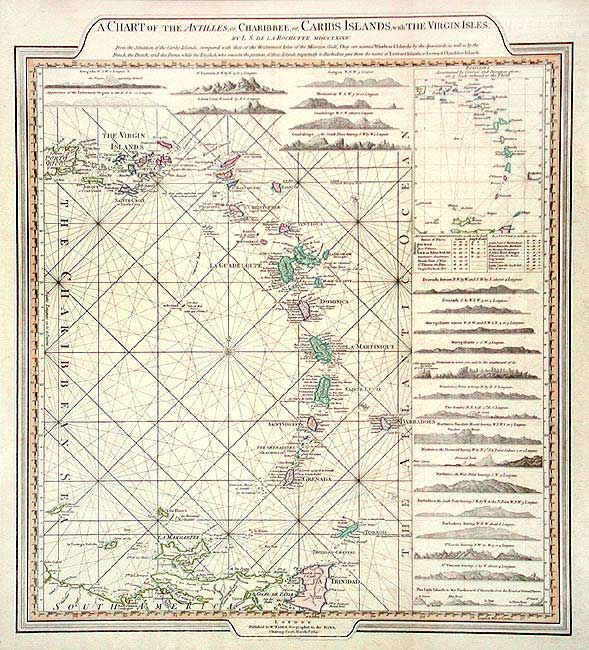
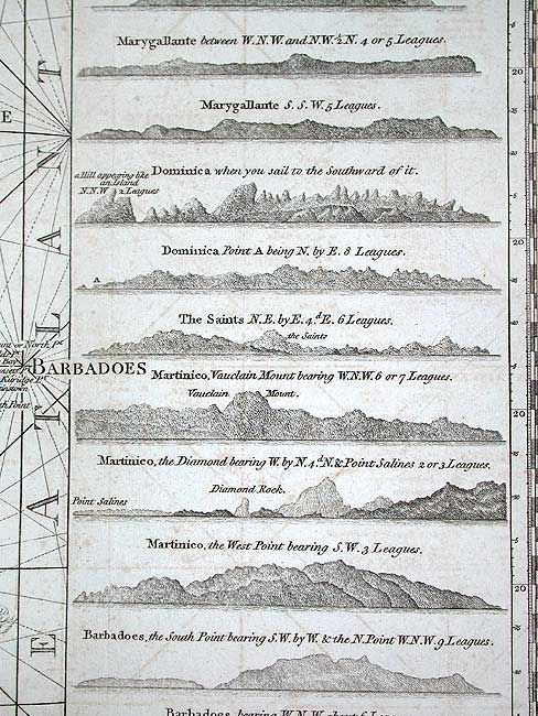
Subject: Lesser Antilles

Period: 1784 (dated)

Publication: General Atlas

Color: Hand Color

Size:
18 x 20.5 inches
45.7 x 52.1 cm
Download High Resolution Image
(or just click on image to launch the Zoom viewer)

A nicely laid out chart with the map at center left, 15 sea-views of island approaches plus another seven above the map, title in a tabbed bar above a multi-scaled border. Covers from the Virgin Islands to Trinidad & Isla Margarita. With rhumb lines and table of Astronomic Observations. Faden published this chart after he succeeded the Thomas Jeffreys as Geographer to the King in 1771. As such had advantage over other publishers with access to government material which was not generally available to his competitors. A very handsome chart that is not often seen.

References:

Condition: B

Good impression and coloring on a full sheet of thick paper. Some off light offsetting, else very good.

Estimate: $450 - $550

Sold for: $1,100

Closed on 9/10/2003

Archived