Catalog Archive
Auction 104, Lot 268

"Insulae Americanae in Oceano Septentrionali, cum Terris adiacentibus", Montanus, Arnoldus

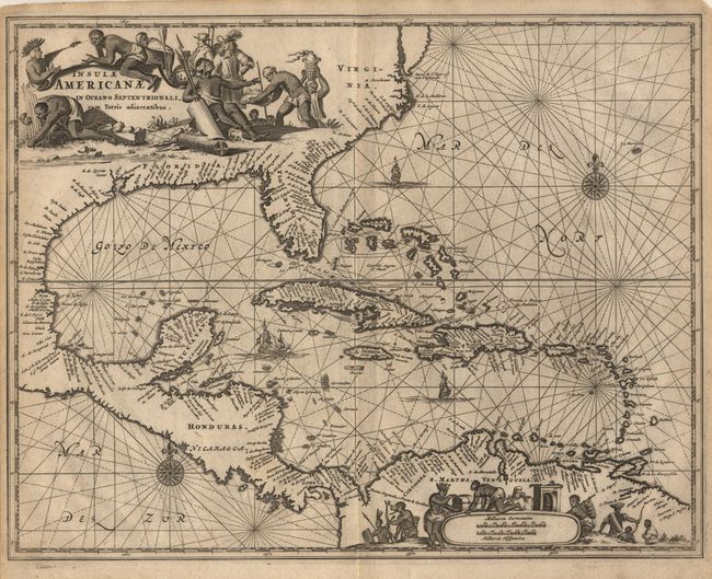
Subject: Gulf of Mexico and Caribbean

Period: 1671 (circa)

Publication: Die Nieuwe en Onbekende Weereld

Color: Black & White

Size:
14.2 x 11.2 inches
36.1 x 28.4 cm
Download High Resolution Image
(or just click on image to launch the Zoom viewer)

Decorative chart of the Caribbean based on Hessel Gerritsz' chart of 1631 and Blaeu's map of 1634. Shown is the area from Virginia and the Chesapeake Bay to the Gulf of Mexico and Central America to the northern tip of South America. Scenic title cartouche fills the North American continent and an equally graphic scale of miles cartouche fills the interior of South America, each surrounded by Native Americans and European merchants. The seas are embellished with rhumb lines, ships and compass roses.

References:

Condition: A

Crisp image and strong paper. Narrow, but adequate, margins as issued.

Estimate: $700 - $800

Sold for: $550

Closed on 9/10/2003

Archived