Catalog Archive
Auction 104, Lot 252

"Map of the State of Texas from the Latest Authorities by J.H. Young", Thomas, Cowperthwait & Co.
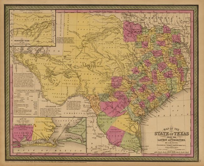
Subject: Texas

Period: 1853 (published)

Publication: Mitchell's New Universal Atlas

Color: Hand Color

Size:
15.8 x 12.8 inches
40.1 x 32.5 cm
Download High Resolution Image
(or just click on image to launch the Zoom viewer)

A very fine map of the state with good margins. The western part is unsettled with counties extending only to Cooke in the north, and Bexar and Kinney in the south. Located numerous forts, trails, wagon roads, springs, etc, including the Comanche War Trail, and Connelly's Trail, and the Emigrant's Route. Filled with place names and interesting explanations and notes. Table gives the population by ethnic groups, e.g. "Free Colored males" is given as 171. Includes insets of Northern Texas and Galveston City. A very handsome map that is becoming increasingly scarce.

References:

Condition: A

Original pastel coloring with pleasant even toning. Two small spots in inset, still very good.

Estimate: $800 - $900

Sold for: $900

Closed on 9/10/2003

Archived